Vendor-neutral point cloud processing

From any point cloudto CAD-ready deliverables

Upload a scan from any scanner. Download finished CAD and GIS files — no desktop software, no workstation.

Works with files from

  • DJI
  • GeoSun
  • Phoenix
  • Riegl
  • YellowScan
  • Leica
  • FARO
  • Trimble
  • GeoSLAM
  • RealityCapture
  • Pix4D
  • Metashape

7 min

for a 1.4 GB scan

40 million points, measured on a real job

10

output formats

DXF, GeoTIFF, LAZ, E57, Shapefile, GeoJSON, PDF

100+

coordinate systems

read from the file header automatically

15 GB

largest file accepted

on Enterprise — 10 GB on Pro, 12 GB on Business

How it works

Three steps, no training

If you can attach a file to an email, you can do this.

  1. 01

    Drop in your scan

    Any LAS, LAZ, E57 or PLY file, straight from the scanner or the photogrammetry tool. Nothing to convert first.

  2. 02

    Pick what you need

    Choose a contour interval, the kind of terrain and an output bundle. The coordinate system is read from the file for you.

  3. 03

    Download and open

    Download the finished files, or send a client the link. Nothing to convert, nothing to post-process.

Upload and walk away

Close the laptop.
We'll email you.

Processing runs on our servers, not on your machine. Once the upload is done, nothing you do locally matters — go to site, go home, go to sleep.

  1. 09:12

    The upload finishes. The job starts on one of our servers.

  2. 09:13

    You close the laptop and leave for site.

  3. 09:54

    An email arrives with a link to the finished files.

Jobs longer than fifteen minutes send the email. Shorter ones are done before you would have noticed.

Why teams switch

Built for the way surveying actually works

Three things desktop tools get wrong, fixed.

Any scanner

Works with every scanner you own

Aerial, terrestrial or handheld LiDAR, and photogrammetry exports too. One tool for the whole fleet, with no vendor software in the loop.

  • LASany LiDAR scanner
  • LAZcompressed LiDAR
  • E57terrestrial scanners
  • PLYphotogrammetry

No install

Runs in the browser, on any laptop

The heavy lifting happens on our servers. Your machine uploads a file and downloads the results — that is all it has to do.

Finished files

Deliverables, not intermediate data

Every file comes out ready to hand to a client. No export step, no manual derivation, no half-finished intermediate data.

CAD
DXF
GIS
GeoTIFFShapefileGeoJSON
Point cloud
LAZE57
Report
PDF
  • Stockpile volumes

    Volume, footprint and height of a single pile, with a depth map, a reliability check and a PDF report that states what was assumed.

  • Coordinate systems

    Reads the CRS from the file header, compound systems included. Reproject on export to any EPSG code.

  • Ground classification

    Separates ground from vegetation and buildings, with presets for open land, forest and built-up sites.

  • 3D viewer

    Look at the point cloud in the browser before downloading anything.

  • Several jobs at once

    Queue up to ten files in parallel on Enterprise, five on Business, two on Pro.

  • Shareable results link

    Send a client a link to the 3D view and the downloads. No account needed on their side.

What you get

Files you can hand over

Rendered by the processing pipeline from a real survey. Each one opens in the software you already use.

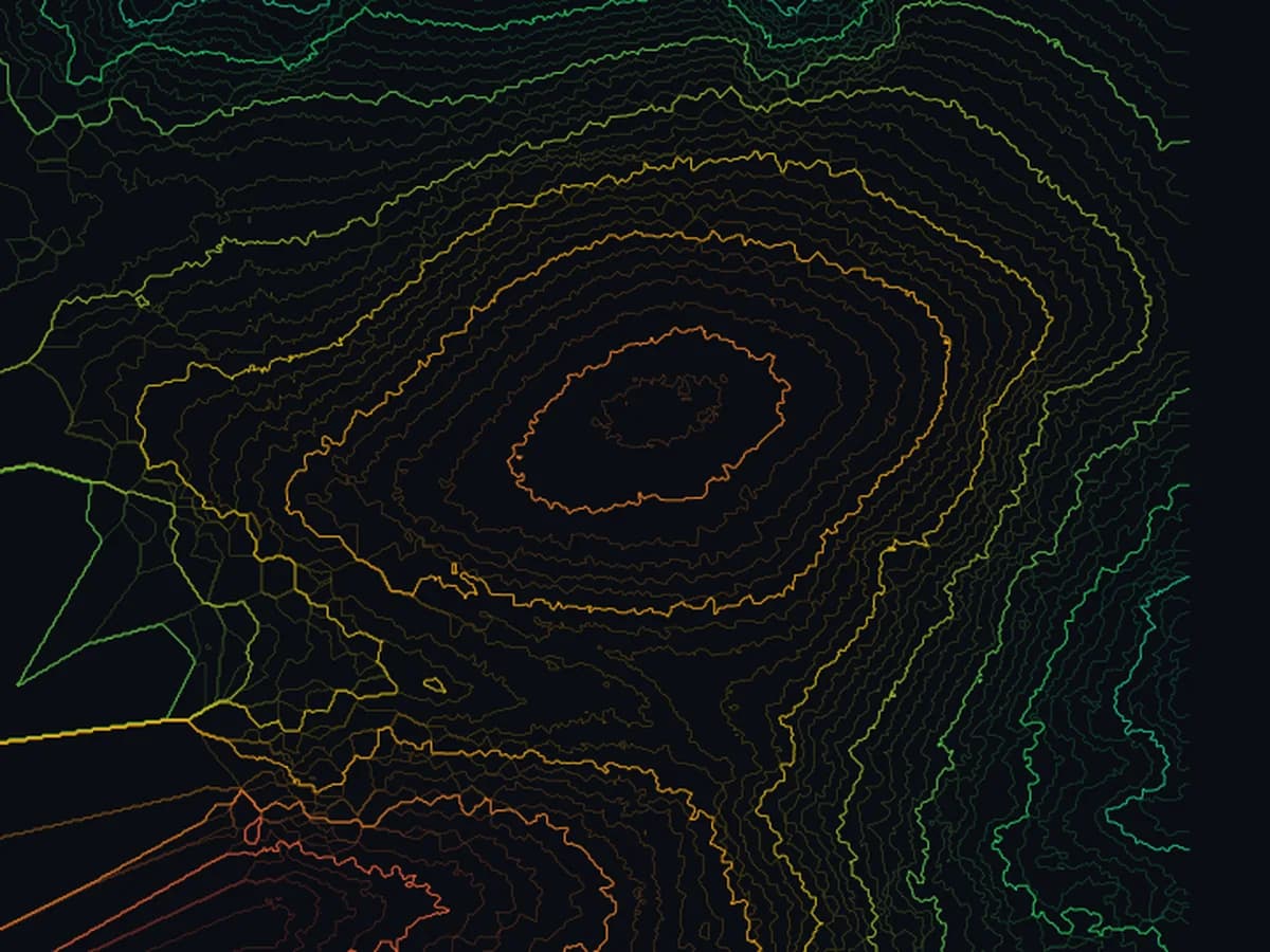
Contour lines produced by the pipeline
  • DXF
  • SHP
  • GeoJSON

Contour lines

Elevation lines at the interval you choose, from 0.25 m to 10 m. Index contours are labelled and sit on their own layer.

Opens in AutoCAD, Civil 3D, QGIS, ArcGIS

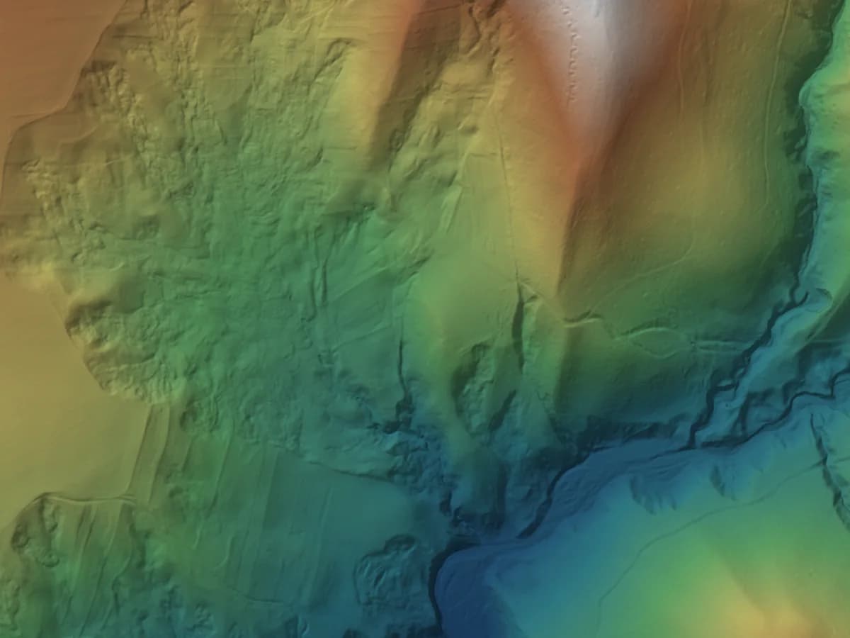
Terrain model produced by the pipeline
  • GeoTIFF

Terrain model

Bare-earth elevation with vegetation and buildings removed. The base every other product is built on.

Opens in QGIS, ArcGIS, Global Mapper

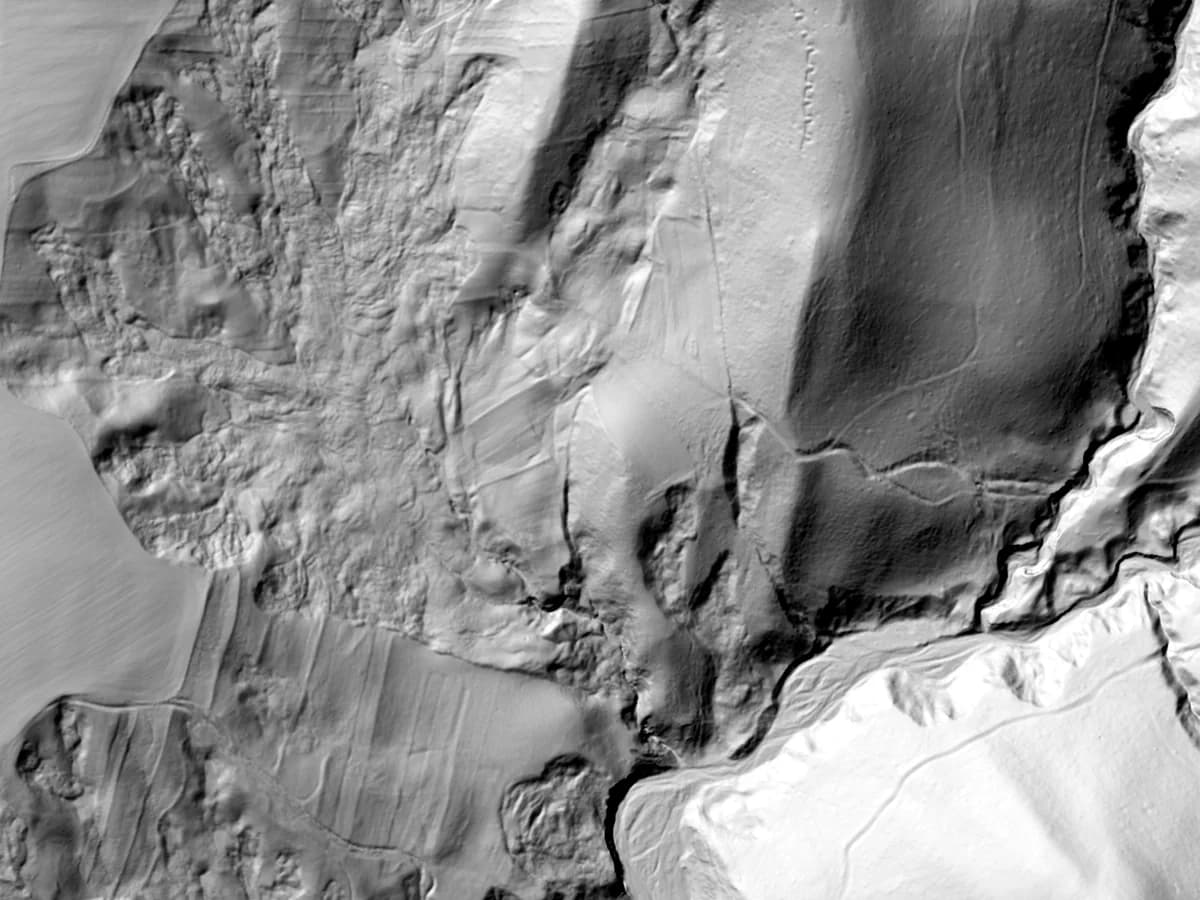
Hillshade produced by the pipeline
  • GeoTIFF

Hillshade

Shaded relief that makes the terrain readable at a glance. The one image a client understands without explanation.

Opens in Any GIS, any report

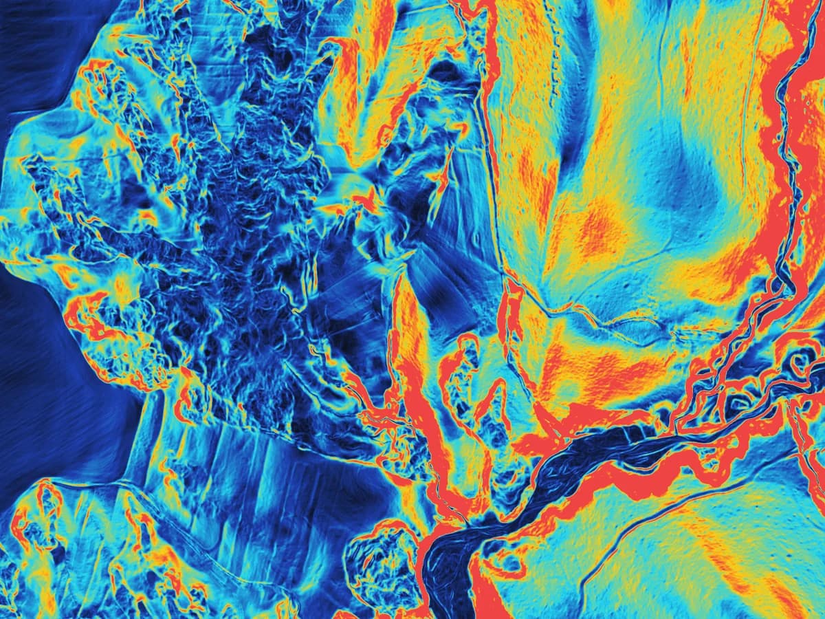
Slope map produced by the pipeline
  • GeoTIFF

Slope map

Steepness in degrees for every cell. Drainage, access roads and stability checks start here.

Opens in QGIS, ArcGIS

Also produced: surface model (DSM), classified point cloud in LAZ and E57, and a stockpile volume report in PDF.

Output bundles

Pick a bundle, not a format list

One choice at upload time decides everything the job produces. Your plan decides which bundles you can run.

Quick contours

Fastest path

All plans

Just the DXF you need to drop into AutoCAD. No extra processing, no extra outputs — smallest file, shortest wait.

  • DXF

When you only need contour lines for a quick CAD overlay.

Surveying essentials

Recommended

Pro and above

DXF contours plus the terrain model, a hillshade and the classified point cloud in both LAZ and E57 — what most surveying jobs actually use.

  • DXF
  • DTM
  • Hillshade
  • LAZ
  • E57

The everyday bundle for surveyors and consultants.

Complete deliverables

Maximum detail

Business and above

Every supported format, including DSM, slope, Shapefile, GeoJSON and a single-scan stockpile volume analysis — ready for GIS, engineering and reporting from one job.

  • DXF
  • DTM
  • DSM
  • Hillshade
  • Slope
  • LAZ
  • E57
  • SHP
  • GeoJSON
  • Stockpile

Includes DSM, which adds roughly 15% to processing time.

Volumetric analysis

Volume only

Business and above

Contour lines, terrain model and a stockpile cubature PDF report — for a dedicated stockpile scan, not a full site survey.

  • DXF
  • DTM
  • Stockpile
  • PDF report

The fastest way to a cubature and a printable report.

Pick a richer bundle on a lighter plan and the files your plan does not include simply do not appear in the result — nothing fails.

Questions

Things people ask before signing up

How long does a job take?

Small sites finish in a few minutes. A 1.4 GB scan takes about seven; multi-gigabyte files can take an hour or more. Anything over fifteen minutes emails you when it is done, so you do not have to wait.

What happens to my files afterwards?

Your uploads are deleted two days after processing and the results stay available for thirty. Download what you need in that window; nothing is kept beyond it.

What if a file is bigger than my plan allows?

You find out before the upload starts: the file header is checked against your plan and you are told which plan would take it. Credit packs cover extra hectares; larger files and finer contours need the next plan up.

Get started

Try it on your next survey

Start on the free plan and upgrade when a project needs more.

No credit card required.